


aguessac

tosan
User
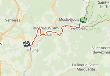

Length
20 km

Max alt
825 m

Uphill gradient
751 m
Km-Effort
30 km

Min alt
366 m

Downhill gradient
784 m
Boucle
No
Creation date :
2024-06-01 06:18:21.1
Updated on :
2024-06-01 14:16:45.0
7h57
Difficulty : Very difficult

FREE GPS app for hiking
 SityTrail
IGN / Geographical institutes
SityTrail Plus
The world is yours!
About
Trail Walking of 20 km to be discovered at Occitania, Lozère, Le Rozier. This trail is proposed by tosan.
Photos


Positioning
Country:
France
Region :
Occitania
Department/Province :
Lozère
Municipality :
Le Rozier
Location:
Unknown
Start:(Dec)
Start:(UTM)
516678 ; 4893051 (31T) N.
Comments